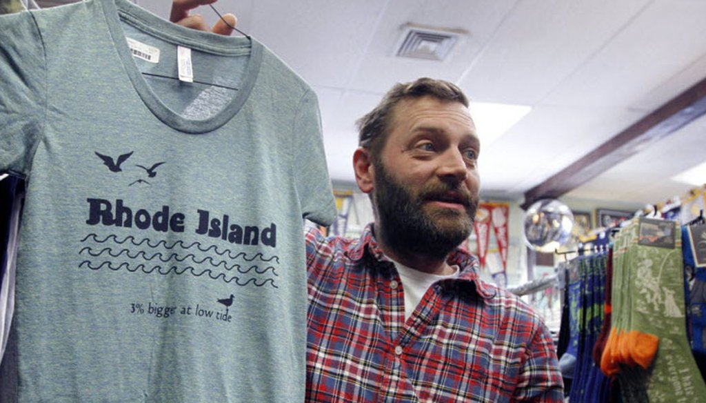

Asher Schofield, designer and co-owner of Frog and Toad holds up a shirt with a RI logo design by artist/designer Hilary Treadwell.
After Rhode Island’s proposed "Cooler & Warmer" slogan tanked, many small-state natives threw their own catchphrases into the mix.
Enter artist Hilary Treadwell, who sells a quirky T-shirt on her website, Lilhop.com. "Rhode Island: 3% bigger at low tide."
Naturally, we asked Treadwell how she came up with this number. That’s what fact checkers do.
She said she made it up.
"I just like the number three, it’s big enough, but small enough," she said.
"It’s a joke that speaks to a truth."
She did look up the state’s area, and the length of its coastline and fiddled around with the numbers, but couldn’t get much farther.
"I would love to know what it really is," she said. "I’m a math nerd, but non-scientific math."
So we dug in.
We quickly discovered this is a tough question, and after tinkering with the Rhode Island Geographic Information System Geospatial Data Catalog for a few hours, we called for backup.
Chuck Labash and Michael Bradley, who work at the University of Rhode Island Environmental Data Center, say an accurate calculation would require a Ph.d. or master’s-level study into shallow water bathymetry (the science of underwater depth) and an analysis of Rhode Island’s tides.
You would need to establish what low-tide measurement to use — Lowest Astronomical Tide, Mean Low Water, or Mean Lower Low Water — then you’d have to check every point in the state at that designated low tide.
Or, you could commission a light detection and ranging airplane flight and measure all of the state’s shores using lasers and sensors within the span of the average hour-long low tide period.
But this would cost "hundreds of thousands of dollars," according to Bradley. We didn’t think our bosses would bankroll that kind of research.
We turned to Bryan Oakley, a geoscientist who studies glacial, coastal, and marine depositional environments at Eastern Connecticut State University. He was able to give us rough some numbers.
Rhode Island is about 1,000 square miles, if you don’t include the water, as the state does in its 1,214 square mile figure. A 3-percent increase in size would be about 30 square miles, or roughly the size of Cranston.
"This seems a tad unrealistic to me," Oakley said.
Here’s Oakley’s cocktail-napkin analysis: Rhode Island has 400 miles of coastline. The intertidal zone, or the area on the shore covered at high tide and uncovered at low tide, is at most 50 feet wide. The fluctuation in size between tides is about 3.7 square miles at most, making the state .37 percent bigger at low tide, he said.
These numbers, he told us, are very rough and his guess is that Rhode Island is about .1 percent bigger at low tide.
Labash and Bradley agreed. So did Jim Turenne, a soil scientist for the USDA-Natural Resources Conservation Service.
Our Ruling:
On T-shirts and postcards, Treadwell writes: "Rhode Island: 3% bigger at low tide."
She admits making that up.
"It’s like I know we’re weird and have problems but hey, we’re still here," Treadwell said.
Besides, who would buy a T-shirt saying: "Rhode Island: 0.1% bigger at low tide?"
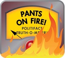
Nevertheless, it’s ruling time and this is certainly a ridiculous (although fanciful) claim.
We rate it Pants on Fire! (Hilary, there’s a genuine, red-plastic, Pants on Fire! button waiting for you at The Journal.)
Interview, Hilary Treadwell, local artist, April 6, 2016.
Lilhop.com, "Shop," accessed April 7, 2016.
Tidesandcurrents.NOAA.gov, "Tidal Datums," accessed April 7, 2016.
RI.gov, "Facts and Trivia," accessed April 7, 2016.
EDC.URI.EDU, "The RIGIS Geospatial Data Catalog," April 7, 2016.
Interview, Chuck Labash, director, University of Rhode Island Environmental Data Center, April 7, 2016.
Interview, Michael Bradley, research associate University of Rhode Island Environmental Data Center, April 7, 2016.
Interview, Bryan Oakley, Quaternary geoscientist at Eastern Connecticut State University, April 6, 2016.
Email, Jim Turenne, a soil scientist for the USDA-Natural Resources Conservation Service, April 6, 2016.


In a world of wild talk and fake news, help us stand up for the facts.