
The newly drawn congressional district map in Arkansas “keeps communities together.”


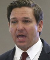
Sen. Tom Cotton, R-Ark., speaks during a Senate Judiciary Committee hearing on Sept. 29, 2021. (AP)

• Arkansas’ newly drawn congressional map reduces the number of split counties in Arkansas compared with the previous decade’s map.
• However, Cotton ignores an unprecedented change in the new map: It splits Pulaski County three ways.
• This split has more impact than other county splits, since Pulaski, which includes Little Rock, is easily the state’s most populous county, as well as the most racially diverse (and most Democratic) big county in the state.
Sen. Tom Cotton, R-Ark., took a swipe at Illinois on Twitter, painting the two states as taking radically different approaches to redistricting — the once-every-decade practice of redrawing congressional and legislative lines in response to the latest census.
Cotton’s Oct. 21 tweet argued that Arkansas’ new congressional district map, drawn by Republicans in an overwhelmingly Republican state, was superior to the one drafted by Democrats, who control the levers of redistricting in Illinois.
"Arkansas Republicans made a compact and fair map that keeps communities together," Cotton tweeted. "Illinois Democrats created an atrocious gerrymander to take power. Yet the Dems are shamelessly attacking Arkansas. Their crocodile tears should be ignored."
For starters, we should note that the Arkansas map shown in Cotton’s tweet was final and had been enacted, whereas the Illinois map was a draft that may or may not be made official. Cotton didn’t mention that. (It’s also worth noting that when population is distributed unevenly within a state — as is the case with metropolitan Chicago in the northeast corner of Illinois — the maps will tend to look messier than in states with smaller variances in population.)
Meanwhile, critics of excessive partisanship in redistricting would find common cause with Cotton on the shape of the Illinois map. Illinois’ draft map — which would likely produce a delegation of 14 Democrats and just three Republicans, in a state that Joe Biden won by a 57%-40% margin — is a "gerrymander that would make deceased Gov. Elbridge Gerry blush," wrote David Wasserman, who tracks redistricting for the Cook Political Report with Amy Walter. (Gerry was an 18th- and 19th-century Massachusetts politician whose reputation for drawing creative district lines produced the term "gerrymandering.")
Still, one of Cotton’s key assertions — that the new Arkansas congressional map "keeps communities together" — is inaccurate, as long as you consider the largest metropolitan area in the state to be a "community." (Cotton’s office did not respond to an inquiry for this article.)
Specifically, the new Arkansas map splits up the largest county in the state — Pulaski County, which includes the state’s capital, Little Rock, which is more than twice as big as the state’s second-largest city, Fayetteville.
Pulaski County is also more racially diverse than the state as a whole. The county is 52% non-Hispanic white and 38% Black, while the state is 70% non-Hispanic white and 15% Black.
This diversity had electoral implications: It helped make Pulaski County one of only eight counties out of Arkansas’ 75 to back Biden in 2020. The Democratic nominee won 60% of the vote in Pulaski County.
For the past decade, Pulaski County has been fully part of the 2nd district, represented by Republican French Hill. Wasserman noted that in recent elections, Hill’s seat has been at least somewhat competitive. Hill won by six points in 2018 and 11 points in 2020.
But by adding rural Cleburne County, where Donald Trump won 81% of the vote in 2020, and subtracting Black neighborhoods in Pulaski County, the Republican map-drawers appear to have succeeded in "downgrading Democrats from a nuisance to total irrelevance" in Hill’s district, Wasserman concluded.
"On the surface, it’s pure gerrymandering," said state Senate minority leader Keith Ingram, according to the Hill. "They took high minority populations and split them. They have diluted the overall impact of the minority vote by doing this."
In fact, the new map doesn’t just just divide Pulaski County — it splits it three ways. Under the new map, only one of Arkansas’ four U.S. House seats doesn’t have a piece of Pulaski County.
That’s a major departure from past practice. The county has never been split between multiple districts "in any decade since the modern redistricting process began in the 1960s," wrote political analyst Reid Wilson after the map was finalized.
Even the state’s Republican governor, Asa Hutchinson, expressed reservations about the map design.
Hutchinson let the map become law without his signature; if he had vetoed it, his veto would have been easily overridden.
"I am concerned about the impact of the redistricting plan on minority populations," Hutchinson told reporters. "While the percentage of minority populations for three of the four congressional districts do not differ that much from the current percentages, the removal of minority areas in Pulaski County into two different congressional districts does raise concerns."
Hutchinson all but encouraged critics of the map to file a lawsuit seeking to overturn it. "This will enable those who wish to challenge the redistricting plan in court to do so," Hutchinson said.
Other Republican officials rejected Hutchinson’s view of the map and echoed Cotton’s assertion that the redraw kept jurisdictions whole.
"The new congressional districts are compact and keep community interests together," state GOP chair Jonelle Fulmer said in a statement. "These lines are largely consistent with the existing lines, which were drawn by Democrats in 2010."
The new map does split fewer counties than the previous map did, cutting the number from five to two. The other split county in the new map is Sebastian County, which includes Fort Smith.
However, splitting Pulaski County has a far bigger impact. At almost 400,000 residents, Pulaski County accounts for 13% of the state’s population. Ranking second is Benton County, which includes Bentonville and Rogers and has 284,333 residents, or 9% of the state’s population.
In the meantime, the Black percentage in Pulaski County is also twice as high as it is in any of the other nine most populous counties in the state, which increases the impact of the split on minority voters.
"There is an argument to be made that the decision to split Pulaski allows for some of the more rural counties to avoid splits, but in terms of population impact, it is clearly divisive," said Hal Bass, an emeritus political scientist at Ouachita Baptist University.
It’s worth noting that in another state where redistricting was controlled by Democrats, Oregon, lawmakers used a similar tactic to produce a favorable map. Democrats enacted a map that split the state’s largest city, Portland, into three districts.
Cotton said that the newly drawn congressional district map in Arkansas "keeps communities together."
The newly drawn map does reduce the number of split counties in Arkansas compared with the previous decade’s map. However, Cotton ignores the most significant impact: For the first time, the map splits Pulaski County three ways. Pulaski is easily the state’s most populous county, as well as the most racially diverse (and most Democratic) big county in the state.
Cotton’s claim has an element of truth but leaves a misleading impression about the impact of redistricting. We rate the statement Mostly False.
Tom Cotton, tweet, Oct. 21, 2021
Cook Political Report with Amy Walter, "Redistricting Snapshots: Arkansas, Michigan, New Jersey, West Virginia," Oct. 15, 2021
Cook Political Report with Amy Walter, "Illinois Democrats Release 14D-3R Draft, but Could Risk a ‘Dummymander,’" Oct. 15, 2021
Associated Press, "Arkansas governor OKs House map splitting Little Rock area," Oct 13, 2021
Associated Press, "Arkansas Redistrict Plan Splitting Pulaski County Advances," Oct. 6, 2021
Arkansas Democrat Gazette, "Arkansas governor to allow redistricting, shot-mandate exemption bills to become law," Oct. 13, 2021
The Hill, "Arkansas legislature splits Little Rock in move that guarantees GOP seats," Oct. 8, 2021
Email interview with Jay Barth, political scientist at Hendrix College, Oct. 22, 2021
Email interview with Hal Bass, emeritus political scientist at Ouachita Baptist University, Oct. 22, 2021


In a world of wild talk and fake news, help us stand up for the facts.